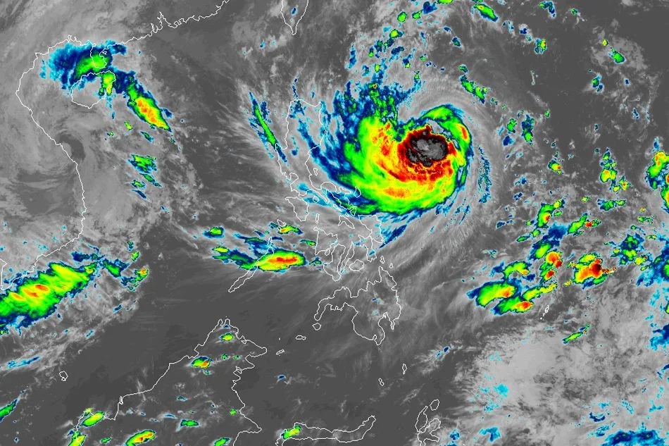
More areas are under warning signal as storm Leon intensifies further
MANILA – As severe tropical storm Leon (international name: Kong-rey) strengthened, the state weather bureau announced Tropical Cyclone Wind Signal No. 1 to more areas on Monday afternoon.
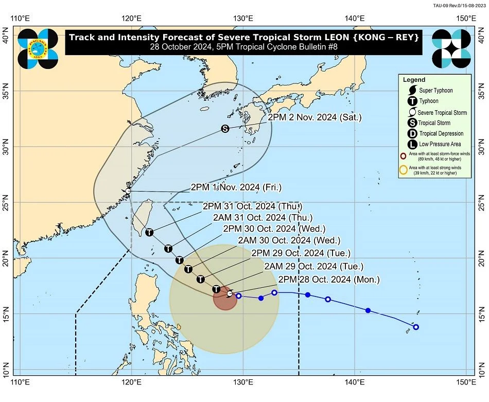
According to PAGASA’s 5 p.m. weather bulletin, Leon was last seen 725 kilometers east of Echague, Isabela, with maximum sustained winds of 100 kph around the center and gusts up to 125 kph.

Leon is now moving west northwest at 15 kph and is expected to continue following this route until Tuesday morning.
Signal No. 1 was issued over the following areas, which might experience severe winds in the next 36 hours:
- Batanes
- Cagayan including Babuyan Islands
- Isabela
- Quirino
- Nueva Vizcaya
- Apayao
- Kalinga
- Abra
- Mountain Province
- Ifugao
- Northern portion of Benguet (Bakun, Kibungan, Atok, Bokod, Mankayan, Buguias, Kabayan)
- Ilocos Norte
- Ilocos Sur
- La Union
- Aurora
- Northern portion of Quezon including Polillo Islands (General Nakar, Infanta, Real), Camarines Norte, the eastern portion of Camarines Sur (Tinambac, Siruma, Goa, Lagonoy, San Jose, Garchitorena, Caramoan, Presentacion, Tigaon, Calabanga, Saglay)
- Catanduanes
- Eastern portion of Albay (Rapu-Rapu, Bacacay, City of Tabaco, Tiwi, Malilipot, Malinao, Santo Domingo, Manito)
- Northeastern portion of Sorsogon (Prieto Diaz, City of Sorsogon, Gubat)

PAGASA further said that the trough of Leon would bring heavy to severe rainfall over Antique and moderate to heavy rains over Cagayan, including the Babuyan Islands, Occidental Mindoro, Negros Occidental, and Palawan, till Tuesday afternoon.
Leon is expected to make landfall along Taiwan’s eastern coast on Thursday before moving northeast into the East China Sea.
While at sea, Leon is forecast to rapidly intensify, potentially reaching typhoon status within 24 hours. It may even reach super typhoon status at its closest approach to Batanes.
It is expected to leave the Philippine area of responsibility on Friday.